
Efforts began this weekend to find the exact spot where a windmill once stood on Southborough Common near Modest Corner.
An area with a raised area of earth has been identified as the likely location and a survey was undertaken of the ground there using professional equipment in an attempt to find evidence of the original four brick pillars that supported the windmill.
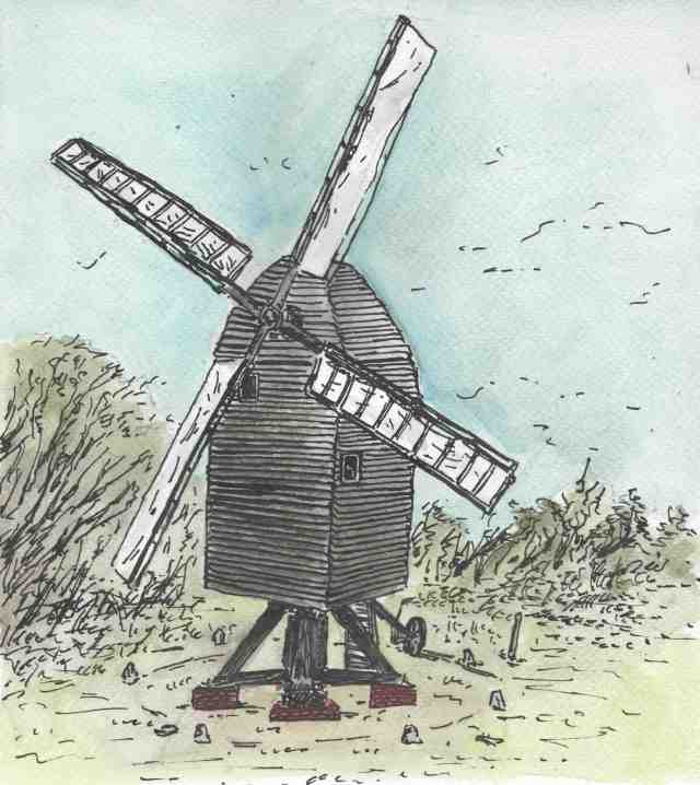
The illustration above by Hugo Webber is based on a windmill at Nutley in the Ashdown Forest that is still operational. It is one of the oldest designs of mill for grinding corn for flour – used in Britain since the 12th Century – and the Southborough Common windmill may have been similar.
Saturday’s survey was organised by the Southborough and High Brooms Amateur Archaeology Society (SHAAS) and the Kent High Weald Partnership in collaboration with Southborough Town Council, which owns the land, and the Southborough Society. Work on Saturday is shown below:
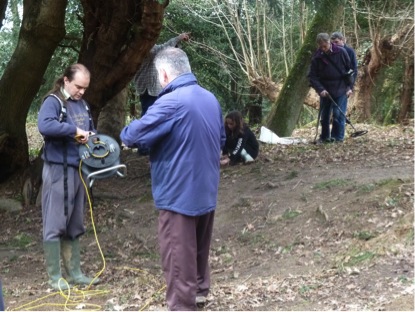
One archaeology expert travelled from the Cotswolds for the occasion and a dozen or so local people helped with the geophysical survey. The organisations will continue to explore the site in the coming months and hope to add to the history of this part of the Common.

Meanwhile SHAAS is also organising a dig at the Ridgewaye allotments on 19th March 2017. It is described as a family archaeology dig and you need to book in advance into two, 2 hour slots from 10am-12pm and 1pm-3pm.
The Society says: “This area has previously produced some interesting artefacts. So SHAAS is inviting you, your family and friends to help us discover more of Southborough’s interesting historical past”.
The dig is suitable for everyone aged 7 years plus. All children below 16 must be accompanied by a parent or guardian. To book email:
info@southborougharchaeology.org
The Archaeology Society is also holding its AGM on the 7th March at 7:30 upstairs in the Imperial pub in Southborough.

From the Southborough Society: In 1789 John Weaver, a miller, was given permission to enclose twelve rods of land from the Common for the purpose of erecting a post Windmill and the site is marked on a map of the Common dated 1793. It was a track that led from the top of the Common through Whortleberry Wood. We don’t know the reason for its disappearance, most likely fire or gales. Remnants of the foundation remained until the hurricane of 1987, when all trace disappeared.
LikeLike
As I’ve said elsewhere, the loss of the post mill at Southborough coincides with the arrival of one at Cage Green in Tonbridge, of which there is a photo. The Southborough mill was last used by the Uridge family who were first millers and owners at Tonbridge, which suggests the mill was moved three miles north. Windmills being moved is not an unusual occurrence, and the timescale and ownership makes it very likely.
The windmill stood at Tonbridge until about 1870, and was a small post mill with a roundhouse. It is unlikely to have been new built at Tonbridge in the 1820s as post mills had been superseded by smock and tower mills by then.
As for remains, the trestle of the mill at Southborough would have stood on four brick piers, which wouldn’t have been moved with the mill (if the move happened) and its more than possible these piers remained undisturbed into the last century.
LikeLike
As children walking through Birch Wood to Southborough, near the top of the path beside Camp Field, there were a few yards of brickwork flat in the path lying in curved lines, as if from a collapsed circular building. Presumably they are still there, under rough ashfelt laid on top.
My father Revd Fred Skinner claimed this was from an old windmill, Where he got that idea from goodness knows – he did not refer to it in his ‘Bidborough – a parish history.’
LikeLike
The actual site of the Southborough windmill was south of Birch Wood on Southborough Common, just north of Modest Corner. The 1868 OS Map marks a circular ‘monument’ in Birch Wood just to the west of a pond. As you say this was in the parish of Bidborough. There is the standing windmill tower in the village which replaced an earlier mill in 1858 and was constructed by Arnolds of Paddock Wood.
LikeLike